Custom Wall Maps with Landowner Names and Property Lines
Besides being the industry leader in publishing plat books, Rockford Map Publishers also produces amazing, high-quality, custom maps for individuals and commercial users. Our custom
Home • Custom Maps
We have the resources, data and artistic talent to create custom maps to meet all of your mapping needs. We love to think outside the box and our Custom Mapping Specialists are ready to hear your ideas. We’ve created thousands of custom maps across the country for a wide variety of customers. Whether it’s for business purposes, personal use or just for fun, Rockford Map can create the right map for you!
Check out our most popular custom maps below and fill out the appropriate quote form so that we can provide you with an accurate free custom map quote.
Whether your area of interest is a single township, multiple townships, or multiple counties, Rockford Map can create the right map for you. Our plat maps show large tract parcels with owner names, acreage and related geographic features, and can be created from our current plat books or historical editions. Great for business or personal use!
Besides being the industry leader in publishing plat books, Rockford Map Publishers also produces amazing, high-quality, custom maps for individuals and commercial users. Our custom
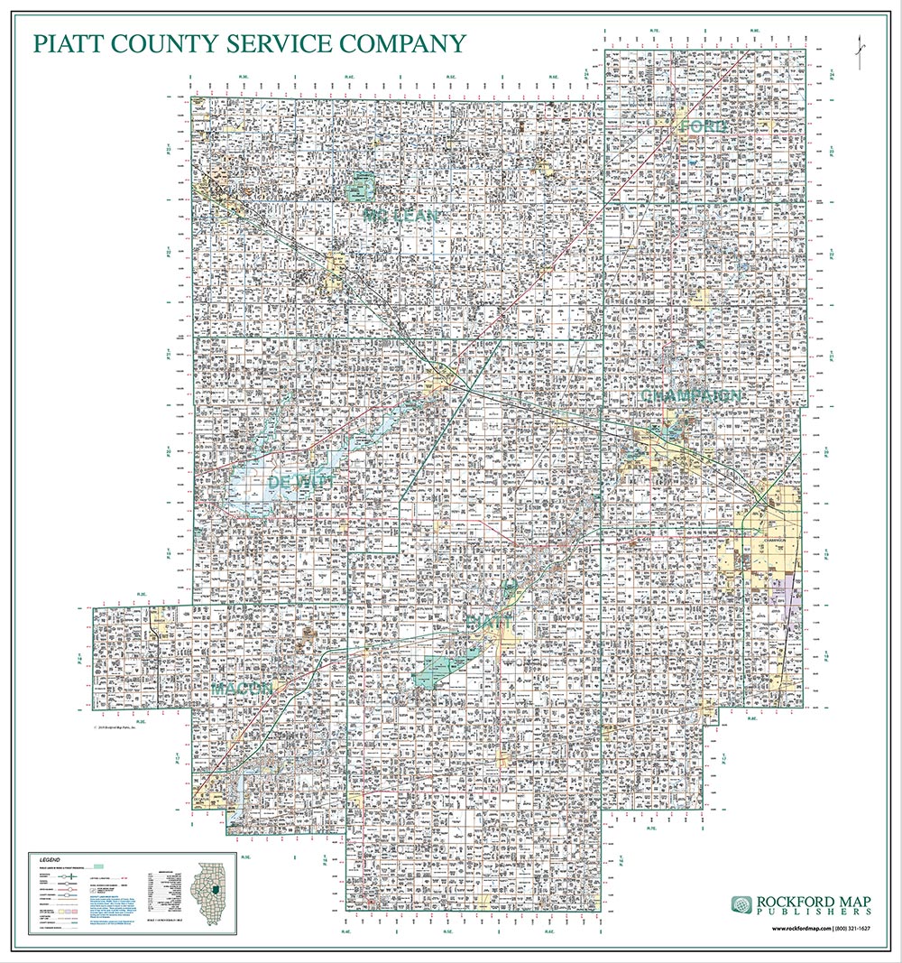
Large multi-county wall maps displaying the landownership information from our plat books are by and large our #1 requested type of custom map. However, depending
Master Edition List via the link below to see if we have mapped your county of interest.
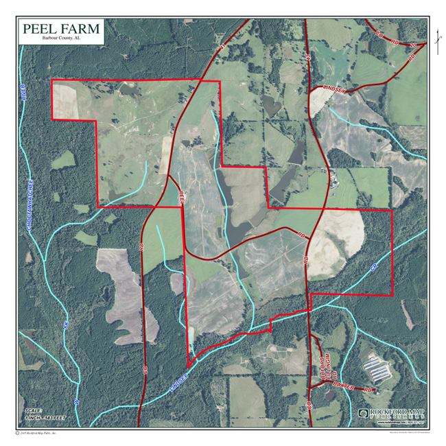
Our custom family farm map is an enlarged aerial view of your parcel showing natural features and your highlighted property. The map is laminated and printed in full-color. Choose a personalized title for your map to make it even more special and unique.
Family farm maps are one of Rockford Map Publishers most popular custom maps for landowners. Maps start at $75 and include a property boundary, aerial photo and a personalized map title. Additional features, such as roads and water can also be added to further enhance your customized map. These also make great gifts.
Rockford Map Publishers produces high-quality custom aerial wall maps that show your property or any other area of land you are interested in. These custom
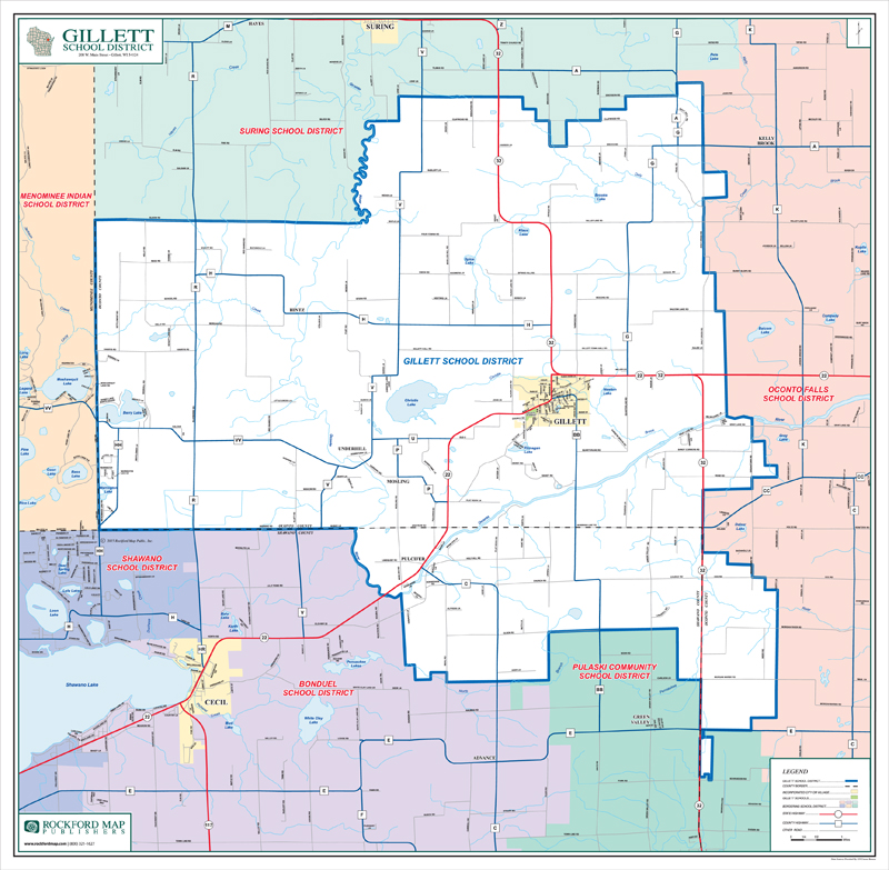
Improve planning and bus routing with a custom school district map. We can make a seamless map of your school district that shows school district boundary lines, schools, city limits, roads, street names, railroads, water and more. These maps come with durable lamination for dry erase writing capability. The maps are full-color and approximately 42” x 54” with hanging bars included. Finished map size and price may vary depending on overall district size and additional requested features.
Rockford Map Publishers helps school districts and superintendents improve planning and bus routing with our custom school district maps. Besides creating high-quality print maps, we offer
Keeping track of your customers and the territory you work in is essential to all service-based commercial companies. Our custom sales territory maps are perfect for anyone who wants to have a visual of your current territory or a planned expansion. Like most of our maps, we can incorporate additional requested data to help you stay on top of your game and ahead of your competitors.
Large multi-county wall maps displaying the landownership information from our plat books are by and large our #1 requested type of custom map. However, depending
One of our more frequently requested custom wall maps are multi-county wall maps that feature landownership information. These are large wall maps that typically consist

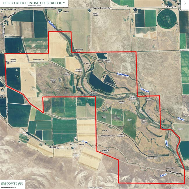
By using aerial imagery provided by the USDA we can create a custom aerial map to show your property or any other area you are interested in. Data can be layered over the aerial image such as parcel boundaries, roadways, landownership information, district boundaries, etc. There are many uses for custom aerial maps whether you want to scout new hunting areas, examine the terrain, or simply want to highlight your property.
Rockford Map Publishers produces high-quality custom aerial wall maps that show your property or any other area of land you are interested in. These custom
We love making custom maps for our customers and whether those users are private or commercial each has a VERY specific purpose for their custom
All of our custom maps are built from scratch so if you have a specific request let us know and we will work with you to get you the map you need. All of our maps are available as print or digital formats and our entire plat map library (historical and new) can be incorporated into any custom map request.